Good Irrigation
Agency maps & charts
The agencies' own maps and charts, loaded live from NOAA and DWR each time you open this page. Click any one to open it at the source.
8–14 day outlook
Precipitation
NWS California-Nevada River Forecast Center


The briefing is updated by 10 AM PT. The observed and forecast maps are thumbnails; click for full size.
Snowpack
DWR CDEC ↗Reservoirs
DWR CDEC ↗Precipitation indices
Water year types ↗These charts come from DWR as PDFs. Some browsers won't show a PDF inside a page; if a box is blank or shows a link, open it with the PDF link above it.
Rivers
NWS CNRFC · DWR CDECThe river forecast map is interactive, so it opens at CNRFC. Live gauge readings are on the Conditions page.
Drought & ET
U.S. Drought Monitor · DWR CIMIS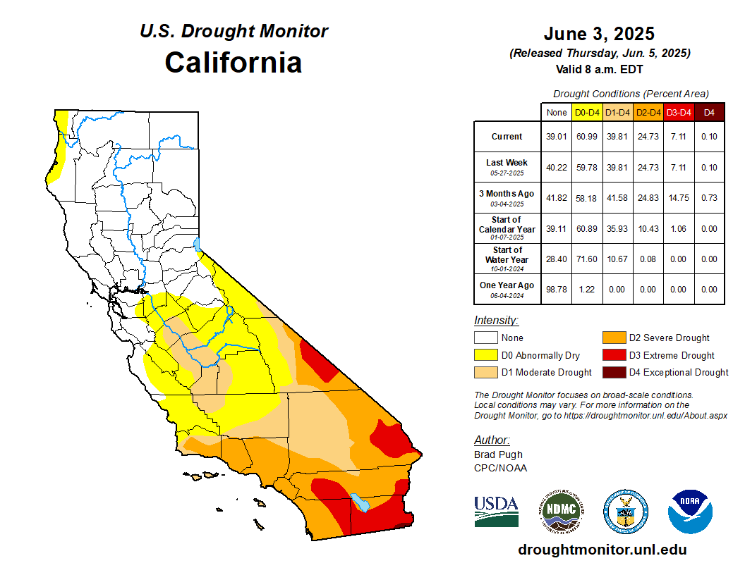
Spatial CIMIS doesn't publish a fixed map image.
Open Spatial CIMIS ↗
Open Spatial CIMIS ↗